 |
| Our local historian and friend, Herb Adams proclaims the Declaration of Independence at the Longfellow House on July 4th, 2017
We recently celebrated our 241st year as an independent Nation. I think it's rather amazing, and, considering the tumultuous century that preceded; perhaps even miraculous. This is certainly evident in Maine's early history,and for the purposes of this blog, the city of Portland. I will not attempt to give a full account of this history, but highlight events that will lead to the re-settlement and the stories of those early settlers of the East Deering Village interred at the Grand Trunk Cemetery.
I'd like to cite a few resources that I found useful and hope that those of you who want to know more details, may find helpful:
William Willis's History of Portland is a prime resource and still insightful for a 21st century reader. William David Barry's Maine: The Wilder Half of New England is well written and documented, as is the book Deering, which I have cited previously. Maine History Online: 1668 - 1774 Settlement and Strive gives an accurate and unbiased account of the period with honesty and clarity.
The first permanent settlement of the area that would ultimately become Portland was in 1633 when George Cleeves and his partner Richard Tucker set about to established a fishing and trading village. At the time the area which included present day Portland, Falmouth, Westbrook, and Cape Elizabeth. was called Casco. The period was marked with disputes with the authorities over land grants, religious affiliations and governance of the province of Maine.
In 1658, the Massachusetts Bay Colony took possession of the area and re-named the town Falmouth. With this action came the development of a court system and town offices that added a measure of security to its citizens. which also included new arrivals from Scotland, Ireland , Wales, the Isle of Jersey and West Africa. Maine became a colony of a colony.
The Indians who resided in the area of Casco Bay were called Aucocisco and were a relatively independent band of Abenaki who fished and planted corn. In 1640, there were only seven families settled in the area: three on the 'Neck' and four along Back Cove. These new-comers were different from the fishermen and traders of the previous decade. It was a relatively peaceful period for the families who began to establish their family farms around Back Cove.
Local Indians maintained a friendly, though cautious relationship with the English, at times "signing deeds to land in return for yearly payments." Deering, pg.33. Tensions grew locally, as more and more settlers arrived and encroached on Indian cornfields by allowing livestock to roam freely, destroying crops.
George Cleeves made conveyances of land principally at Back Cove to several people shown by deed to be living there about 1658:
George Ingersoll, George Lewis, John Lewis and Nathaniel Wallis, Thomas Skillings( These will become important later in our story.)
By 1670, more than a dozen closely related families had established farms along Back Cove to Martin's Point. Some of the names that are known are:
Anthony Brackett, George Lewis, John Lewis, Philip Lewis, Phineas Rider, James Ross, Thomas Skillings, Nathaniel Wallis, Thomas Wakely and Matthew Coe. In total, by 1675 there were forty families spread out through Falmouth.
In the beginning of the year 1675, the prosperity of the town stood at a high point; population had been steadily increasing in every part, and its various resources were rapidly developing. Mills had been established at Capisic and on the lower falls of Presumpscot River, and the borders of both rivers were occupied by an active and enterprising people. But their opening prospects were destined soon to be changed, and their hopes crushed.William Willis: The History of Portland, From 1632 - 1864 From 1675 - 1763, Maine became the killing ground in a series of brutal. debilitating wars between the English and the combined forces of France and the Indians.William David Barry: Maine: The Wilder Half of New England
Barry reflects on the account of the " attack on Pemiquid from the words of John Gyles while working on his family farm, and says this:
The attack on Pemiquid might stand for the hundreds of attacks and ambushes that occurred between 1675 and the Treaty of Paris in 1763. It was a war of no quarter in which both sides killed old and young alike in a fury of racial hatred and struggle for land. All of this was set against the backdrop of Anglo- French rivalry on a world-wide scale.************************************************************************************ By the middle of the 17th century, the Abenaki were living in a nightmarish landscape shaped by conflict, disease, and alcohol and they turned to the (French) missionaries for help and reassurance. In summer 1675 war broke out in Southern New England between Pilgrims and Wampanoags led by King Philip, or Metacomet and strained relations through New England. Relations between French "Papists" and Indian "heathens" fueled English fears that all Indians were conspirators of King Philip, and with war raging to the south, the General Court sent commissioners to Maine trading posts to enforce the ban on arms. English scalp hunters were paid bounty to hunt Indians south of the Piscataqua, no doubt crossing over the river into Maine as well. Maine History Online-1668 - 1774 Settlement & Strife ***************************************************************************
In 1676, Falmouth was attacked and the Wakley family killed with two children taken captive. Raids continued on English villages from Saco to Casco Bay. Later, settlers all through the region would look for escape on islands or further to Salem or New Hampshire. The settlement at Falmouth would remain abandoned for two years. When they returned, the English colonists erected Fort Loyall to defend against future attacks,
Attempts were made by both the English and the Indians to negotiate peace but these were unsuccessful and conflict continued. From 1689 until 1699, Comte de Frontenac, the governor of New France set out on a campaign to conquer all of North America. Large forces of French and Indians drove the English from settlements east of Falmouth.
In September 1689, 200 Norridgewock, Penobscot, and Canadian Indians landed on Peaks Island, and on September 21st attacked the Back Cove settlements. Having gotten word of the potential attacks, Massachusetts sent Major Benjamin Church, noted Indian fighter along with several militia units to aid the locals.

Near dawn on September 21, 1689, a flotilla of war canoes crossed Back Cove and attacked the Brackett Farm. Anthony Brackett gave the alarm and sent his sons to the Neck for help. Church and his force of 200, joined by the Casco militia, raced through the thickets toward Ware Creek. A brutal, daylong pitched battle took place where now I-295 separates Deering Oaks from the University of Southern Maine. Fought across the tidal stream and on a small bridge, probably near the corner of Congress and St. John's Streets, the battle raged until the Indians withdrew. The sense of victory was short lived, however, for Church was obliged to return to Massachusetts.Deering: pg. 34
Although the majority of settlers wanted to leave the village expecting reprisals in the spring, Benjamin Church convinced many to stay, promising to do all in his power to return or send necessary aid when he gave his report to the authorities in Massachusetts. Unfortunately, his pleadings and those of Silvanus Davis who would become the Commander of Fort Loyall in 1690 laid on deaf ears until it was too late. For those of you who want to read the full account of the siege of Fort Loyall and the Destruction of Falmouth, I recommend either the online version or in book form:

It is an amazing story of bravery, brutality, shame, ruthlessness and stupidity that led to the abandonment of a young but potentially prosperous settlement for twenty-five years. It's a very long document, but I think some would find it interesting and quite a story. It was presented to the Maine Genealogical Society on June 2, 1885 by editor John T. Hull.
I'm going to end this post with the account of the siege from the words of Capt. Silvanus Davis, taken from William Willis recorded in the History of Portland.

|
Monday, July 10, 2017
Portland


Saturday, June 24, 2017
RESETTLEMENT: OLD PROPRIETORS/OLD SOLDIERS/NEW SETTLERS: An Introduction
In 1699, Colonel Wolfgang William Romer returned with an exploratory expedition. From the Fort Loyall ruins, Romer wrote,
"There are still to be seen the remains of houses of two stories high, with stone walls and chimneys, and there are 180 farms, beside a great many fisherman's houses. 'Tis a great pity that so fine a country should be deserted."(Taken from Deering; A Social and Architectural History by William David Barry and Patricia McGraw Anderson, pg. 35.)
The reference speaks to the abandonment of the town of Falmouth, which included all of Portland, Westbrook, South Portland, Cape Elizabeth and present day Falmouth, after the destruction of Fort Loyall and the massacre of 200 men, women and children in May of 1690. the frightened folks had received an alarm about the potential invasion by French and Native forces and gathered for protection at the fort at the foot of India Street
The constant and acrimonious relationship between the French and English for dominance and possession of the province of Maine resulted in open warfare where, for the most part, the first Nation members sided with the French and put the inhabitants of ancient Falmouth in peril. The whole area remained uninhabited for twenty-six years until the Treaty of Portsmouth also referred to as the Treaty Utrecht in 1713.

https://portland.bangordailynews.com/2017/05/15/history/after-this=massacre-portland-was...
Troy R. Bennett is a photo journalist who recently presented an excellent piece on the destruction of Fort Loyall that I'm sure followers of this blog will find interesting. I really enjoy Troy's work and though he claims not to be an historian, nor am I, his vignettes of historical events in Portland history create a vivid and entertaining picture of the past. I was pleased and a bit surprised to see that Troy Bennett chose to dedicate two articles to two of our inhabitants of the East Deering/Grand Trunk Cemetery: William Blake and the younger Crispus Graves. Both video tapped at the cemetery.
*********************************************
Before venturing further, I want to acknowledge that for the last several months I have been accumulating notes and stories which have led to my taking a look backwards in order to understand how it is that the key players in the Back Cove settlement around the area associated with our Grand Trunk Cemetery came to be. As a result, I have been dragging my 'mental feet' in the hope of achieving a better understanding myself of the who, what, when and where.
Beside the Deering book, I used Theodore Sawyer's Back Cove to Quaker Lane to look more closely at the land grants purchased by Isaac Sawyer, Joseph Noyes, Isaac Illsley and Jasper Blake. I found myself wanting to know more about the people from whom they purchased their land: the names of Moses Gould, Ebenezer Hall, Sr., Eben Hall, Jr. Cornelius Hall, John Wass, and others kept appearing. I learned that the Halls and Moses Gould were soldiers who served in the conflicts between the French and English and were probably among the soldiers who returned to the area with Major Samuel Moody and actively engaged in resettlement. I learned that Isaac Sawyer received his grant through John Wass and this was originally a grant from George Cleeves, considered to be the founder of Portland.

 |
The statue of George Cleeves was donated to the City of Portland by his descendants, however the City Council declined the offer. The statue is now located on private property over looking Portland Harbor, because controversy ensued over whether Cleeves and his family kept a slave. There was never substantial evidence as to the veracity of this claim. |
Please view this post as an introduction to a series which I hope readers will find interesting and informative and helpful in doing your own historical sleuthing. Signing off for now!
Thursday, May 25, 2017
A Day of Remembrance
Yesterday afternoon, Joel and I visited the old cemetery to bring new flags and wreathes to place at the Grand Trunk Veterans Memorial and, at the still recognizable graves, of two veterans of early wars in American history. This has become a part of our ritual for celebrating Memorial Day since undertaking the restoration of this cemetery.
 |
| The Grand Trunk Cemetery Veterans Memorial Honoring Ten Veterans of The Revolution, The War of 1812 and The Civil War |
 |
| The Graves of Simon Davis, Revolutionary War and Francis Smith, War of 1812
Over the years, since the first Memorial Day, then called Decoration Day, was celebrated shortly after the Civil War, first, in various locations by individuals in separate communities, Memorial Day as we know it, has taken on significant meaning for families in the United States.
As a girl, I remember the visits to the cemetery to cleanup and plant at the graves of my grandfather and other relatives, loved ones who had passed away. I remember parades to honor soldiers who had died on the battlefield and purchasing the red paper poppy to wear. I still do this today.
Although Memorial Day did not become a federal holiday until 1971 by an act of Congress, it was celebrated by Americans across the nation for a very long time. I found this short piece regarding the history of the day that I thought worth sharing.

After World War I, the so-called, war to end all wars, people began to recognize all veterans who had died in America's wars. This Memorial Day poster from 1917 with its vivid images shows this change of sentiment and regard.

Memorial Day is a day to remember all our deceased Veterans, those who paid the ultimate price and died on the field of battle and those who served to win and preserve our freedom and liberty."We are the home of the 'free' because of the 'brave'."
I've heard it said, that repeating the name of someone who has died is a small way to remember them and assure they will not be forgotten. With this in mind, Joel and I read the names of our ancient veterans aloud with only the birds and squirrels to hear among the rustling leaves. None-the-less, perhaps, dear reader, you will do the same to honor them.
SAMUEL BLAKE, PRIVATE
Born: 1794, Died: February 14, 1846
THE WAR OF 1812
WILLIAM BLAKE, PRIVATE
Born: March 6, 1774, Died: October 1853
THE WAR OF 1812
SIMON DAVIS, PRIVATE
Born: September 2, 1765, Died: March 17, 1810
THE REVOLUTIONARY WAR
ANDREW GRAVES, PRIVATE
Born: 1774, Died: November 28, 1860
THE WAR OF 1812
ENSIGN/LIEUT. CRISPUS GRAVES
Born: 1742, Died: March 14, 1818
THE REVOLUTIONARY WAR
JOSEPH LUNT, PRIVATE
Born: April 3, 1757, Died: September 15, 1804
THE REVOLUTIONARY WAR
JOSEPH MERRILL, PRIVATE
Born: 1754, Died: April 8, 1823
THE WAR OF 1812
JAMES MOSELEY, PRIVATE
Born: 1836, Died: December 10, 1892
THE CIVIL WAR
JOHN SAWYER, JR.,PRIVATE
Born: November 13, 1760, Died: December 6, 1842
THE REVOLUTIONARY WAR
AND
THE WAR OF 1812
JOSEPH MERRILL SAWYER, PRIVATE
Born: August 1795, Died: June 1, 1875
THE WAR OF 1812
WILLIAM SAWYER, PRIVATE
Born: 1763, Died: May, 14, 1825
THE WAR OF 1812
FRANCIS SMITH, PRIVATE
Born: 1791, Died: June 1, 1840
THE WAR OF 1812
******************************************
I came across this little poem and chose to read the first few stanzas as they seemed appropriate to the moment:

Finally, to honor other unknown and long forgotten Veterans who may be interred in the Grand Trunk Cemetery in unmarked graves, we placed this wreath at the Early Settlers Memorial.

We did not sing Taps. We reserve that for more auspicious moments, and better voices. I will share the words for those of you who might want to hum the tune yourselves as you celebrate this Memorial Day by visiting a local Veterans cemetery or burial site.
 |
Friday, May 19, 2017
The Search continues:
In my last post, I posed the question" Why did they ( the neighbors and land owners) settle on this spot to bury their dead?" No deed seems to exist establishing the burying ground. There is no mention of the actual burying ground until 1814 when Thomas Blake sold property, originally belonging to his father John Blake inherited from his father, Jasper Blake. The burial ground is specifically noted as a surveyor's marker to establish property boundaries.
Obviously, a lot of family life was lived and history passed, from the resettlement of the area from 1725, when Isaac Sawyer Sr., his children and grandchildren arrived, and five to ten years later, Joseph Noyes, Isaac Ilsley, Jasper Blake and others. Before delving into a discussion of these land owners, I want to try to understand some of the thinking and practices of the historic period.
Each of these men and their families owned substantial farms; 100 or more acres of land, running from our present Ray Street to the waters edge bordering on the old Back Cove Road (Ocean Avenue.) It would be very interesting to plot out these farms and with the help of the Portland Public Works archivist, I really hope to be able to do this in the near future.
**************************************************************


Obviously, a lot of family life was lived and history passed, from the resettlement of the area from 1725, when Isaac Sawyer Sr., his children and grandchildren arrived, and five to ten years later, Joseph Noyes, Isaac Ilsley, Jasper Blake and others. Before delving into a discussion of these land owners, I want to try to understand some of the thinking and practices of the historic period.
Each of these men and their families owned substantial farms; 100 or more acres of land, running from our present Ray Street to the waters edge bordering on the old Back Cove Road (Ocean Avenue.) It would be very interesting to plot out these farms and with the help of the Portland Public Works archivist, I really hope to be able to do this in the near future.
**************************************************************
I recently visited the Quarry Run Dog Park at the juncture of Presumpscot Street and Ocean Avenue built sometime in the 90's at the foot of the old city landfill. As I walked through, I had an 'ah ha' moment. Standing at the base of what looks like a giant meadow with walking paths which will take you to Maine Avenue and beyond. There are remnants of the old rock walls which probably were part of farms: Sawyer's or Noyes'? I still need to trace the records through the City Assessor's office to see how far back they go; but that for another day!
 |
| Stones from original farm walls |


 |
| View from top of the hill. |
It is very hard to imagine what the terrain was like in the 1730's, but this area peeked my curiosity. Later, I will share what I've learned about the land owners, their property purchases and their impact on the history of Back Cove/East Deering and ultimately, the city of Portland.
I recently borrowed an interesting little book from the University at Orono which provides some insight into burial practices, in rural New England and its frontier settlements; in particular, old Falmouth.
Mortuary Monuments and Burial Grounds of the Historic Period is described as a manual in archaeological methods, theory and techniques, written by Harold Mytum, published in 2004, by Kluwer Academic/Plenum Publishers, New York.
In the section: North American Burial Grounds; Colonial North America, the author cites three main locations for formal burials:
- individual farmsteads
- community burial grounds
- in and around parish churches
Farmstead burials often happened in clusters, not far from buildings. "Burials derived from one family farm or, at most, a few farms." pg. 18. This might well fit the criteria for the Presumpscot/Grand Trunk Cemetery where the early farms were in close proximity to one another.
Mytum also describes Community Burial Grounds which could also describe the Grand Trunk Cemetery as we know it today. During the 17th century in New England, burial grounds were often a distance away from the center of a community's meeting house. Funeral processions traveled from the home of the deceased to the burial ground where a ceremony, probably civil, not necessarily religious was conducted.
As populations moved into dispersed settlements, in the late 17th century, burial grounds became more centrally located. Funerals included a religious component with prayers, and, for the more prominent deceased, a sermon delivered at the meeting house.
The rural farmstead burial grounds continued and are evident throughout Maine. Small rural cemeteries are frequent. Some are associated with particular churches, others for whole communities. Although there is no deed establishing the burial ground from a particular land owner, it is clear that the site was chosen and used very early on.
Those who follow this blog know that I am concerned about the history that has been lost or misplaced regarding the Back Cove/ East Deering early settlers. The survey conducted by the WPA in 1936 is incomplete because of the missing grave forms.
Earlier, I posted a photograph of the map of the cemetery drawn by the surveyors indicating the measurements, gate, rail and wooden fences. The final report indicated there were 197 marked graves. However, what do these numbers indicate from each of the individual graphs. Were there more burials? What were they looking at, and what evidence allowed them to pin point the 197 marked graves? So much of Portland history still needs to be archived before it becomes lost forever.
 |
| Please note the numbers for each section as they were plotted by the surveyors. |
Finally, I want to thank Martha Zimicki, conservator from the group Spirits Alive, for stepping forward to restore Agnes Wilcox memorial stone to its base.
Spirits Alive has done a fantastic job preserving our Eastern Cemetery. I am grateful for their expertise and commitment.
Memorial Day is approaching and we will lay flags at the Grand Trunk Veterans Memorial and the graves of Simon Davis, Revolutionary War, and Francis Smith, the War of 1812 veterans on Wednesday.
 |
| We Remember |
Monday, May 8, 2017
A LOVELY DAY FOR OUR ANNUAL SPRING CLEANUP AT THE GRAND TRUNK CEMETERY
May 7th, 2017 turned out to be a day on which Mother Nature was kind....no rain, cool temperatures, a bit windy, but otherwise, perfect for this endeavor. Leaves were piled into twenty or more bags, broken branches removed, shards of the never ending broken glass picked up, and the commitment to keep this little cemetery, with its remnants of broken memorials
dedicated to souls who lived long ago, is alive and well, because of the efforts of Portland Girl Scouts, family and Friends of the Grand Trunk Cemetery.
I want to express my sincere appreciation to all who participated:
Lynda Allshouse Janet Christopher, Machigonne Service Team
Rachel Stellmach, Troop 1940 Kathy and Ava Plourde, Troop 1094
Sophie Volk Francesca Marinaro Charlene Marinaro, Troop 1094
Jaden- Anna Morse Beth and Subine O'Malley Rob Levin
Staci Hanscom, Troop 1547 Brianna A. Ava Googins
Leila Goan Keegan P. Cedar Levin, Troop 1940 Sarah K. Goan
I apologize if I've left anyone out or misspelled a name. Please let me know so that I can correct the record. Here are photos of these industrious souls.


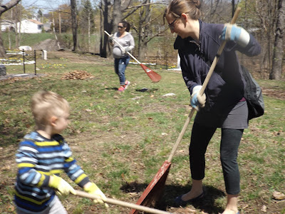


I am also grateful that Martha Zamicki, from Spirits Alive stopped by to take a look at Agnes Wilcox stone which had toppled from its base. Martha assures me the repair to the stone will be easy for her. That's good news since this gravestone is one of only two of the early stones which has survived in tact. The other belongs to the younger, Crispus Graves, grandson of Lieut. Crispus Graves and son to Andrew Graves.
As we walked along the bumpy pathway and looked at the bits of broken stones, I realized that as has always been the case since beginning this recovery project seven years ago, I have more questions than answers. But one in particular has surfaced over the last few months, as I have looked more closely at the numerous early deeds belonging to the land owners whose farms were established along the rim of Back Cove and our present Ocean Avenue. Why did they settle on this particular spot, surrounded by woods, a fair distance from their own homes to lay their dead to rest? This was, by no means, an easy task. Family members would have had to carry the deceased in a wooden casket across fields and through woods either on foot or in a wagon on unpaved roads or foot paths. More perplexing questions to follow very soon.
The East Deering/Grand Trunk Cemetery is particularly lovely this spring because of the flourish of yellow color provided by the daffodils in full bloom. I invite you to stop by. Sit a while on the bench and enjoy a moment of quiet reflection and peace.


dedicated to souls who lived long ago, is alive and well, because of the efforts of Portland Girl Scouts, family and Friends of the Grand Trunk Cemetery.
I want to express my sincere appreciation to all who participated:
Lynda Allshouse Janet Christopher, Machigonne Service Team
Rachel Stellmach, Troop 1940 Kathy and Ava Plourde, Troop 1094
Sophie Volk Francesca Marinaro Charlene Marinaro, Troop 1094
Jaden- Anna Morse Beth and Subine O'Malley Rob Levin
Staci Hanscom, Troop 1547 Brianna A. Ava Googins
Leila Goan Keegan P. Cedar Levin, Troop 1940 Sarah K. Goan
I apologize if I've left anyone out or misspelled a name. Please let me know so that I can correct the record. Here are photos of these industrious souls.


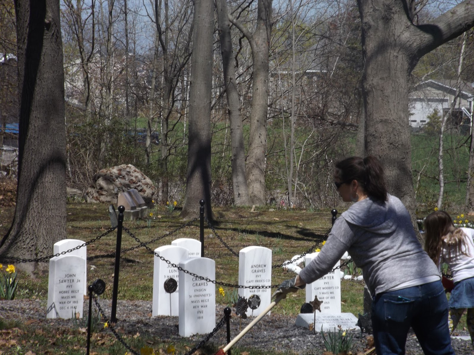





I am also grateful that Martha Zamicki, from Spirits Alive stopped by to take a look at Agnes Wilcox stone which had toppled from its base. Martha assures me the repair to the stone will be easy for her. That's good news since this gravestone is one of only two of the early stones which has survived in tact. The other belongs to the younger, Crispus Graves, grandson of Lieut. Crispus Graves and son to Andrew Graves.
As we walked along the bumpy pathway and looked at the bits of broken stones, I realized that as has always been the case since beginning this recovery project seven years ago, I have more questions than answers. But one in particular has surfaced over the last few months, as I have looked more closely at the numerous early deeds belonging to the land owners whose farms were established along the rim of Back Cove and our present Ocean Avenue. Why did they settle on this particular spot, surrounded by woods, a fair distance from their own homes to lay their dead to rest? This was, by no means, an easy task. Family members would have had to carry the deceased in a wooden casket across fields and through woods either on foot or in a wagon on unpaved roads or foot paths. More perplexing questions to follow very soon.
The East Deering/Grand Trunk Cemetery is particularly lovely this spring because of the flourish of yellow color provided by the daffodils in full bloom. I invite you to stop by. Sit a while on the bench and enjoy a moment of quiet reflection and peace.


Monday, April 10, 2017
SPRING 2017\PRESERVING THE REMNANT
 |
| Daffodils Poking up. Spring is in the air finally!
Joel and I headed out this morning to check on any winter damage at the Grand Trunk Cemetery and were happy to find the little green shoots poking through the earth. As usual, there were a number of broken limbs from some of the old trees. Last fall, the city's Forestry Division did cut back a few of the dead trees. There is still more work to be done.
Surprise! The wreath that had been donated by Officer Haley was not stolen after-all; it was buried under the snow! So grateful it was not taken, restoring my faith in the general goodness of the neighbors and people who have come to appreciate this small, sacred space.
Unfortunately, the white marble gravestone marking Agnes Wilcox ( b. 1820, d. April 2, 1864) grave has fallen off its base. The brass pins have worn away and will need to be replaced and the stone reset. I am hoping for expert direction and help to do this. The base is granite, I think, and the pins look like they were drilled in place and ran up into hollowed out segments of the marble stone. Hoping for some help here?
We removed the tarp from the kiosk and will put up the critter cam to discourage mischief makers from vandalism. Wish that would work for the critters who have started their Spring ritual of digging holes in the cemetery!
ANNOUNCEMENT |
Each Spring and Fall since Samantha Allshouse and Kayla Theriault began this restoration project in 2010, Portland Girl Scouts and our informal 'Friends of the Grand Trunk Cemetery' have held two events spending a Sunday afternoon at the cemetery cleaning up or planting. This year our Spring Cleanup Day is on Sunday, May 7th. Hope that those of you who are local will consider giving and hour or two to continue this work; it is well worth the effort and truly appreciated.
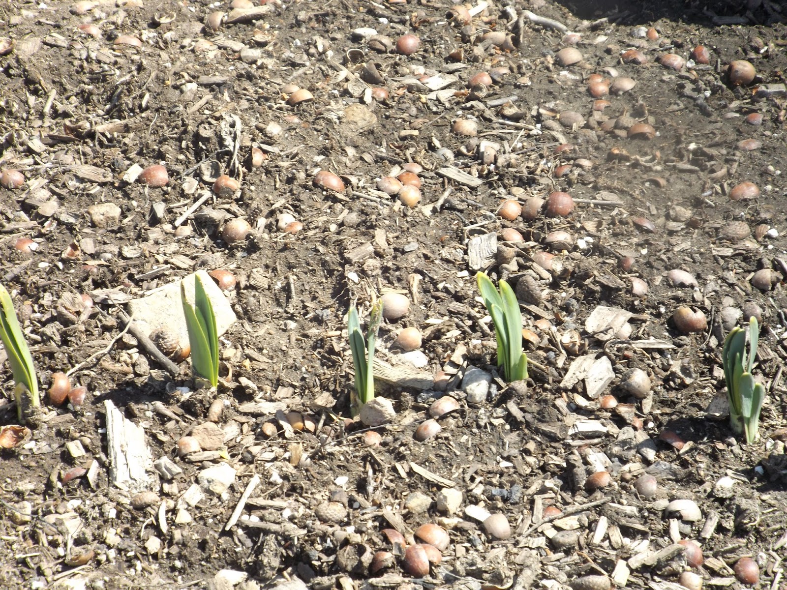 |
| Daffodils should be glorious in May |
Saturday, February 25, 2017
Looking Back
WINTER 2017 AT THE GRAND TRUNK CEMETERY


This latest post is by way of an introduction to work that is an on-going attempt to look more closely at the historical events that led to the establishment of the cemetery, about two hundred and seventy years ago. Who set off the land for the purpose of burying the dead? Who, among those early settlers, was interred here first? When did it became the common burial ground for neighbors and families that resided in this area of what is now part of the city of Portland, Maine?
In the period of the re-settlement from 1726, when Isaac Sawyer, Sr. yeoman, from Gloucester in Essex County, Massachusetts Bay Colony, purchased land here in the district of Maine, he became a resident of Falmouth, and the area in which he resided was called Back Cove. This Sawyer, along with his wife and children were the first and second generations of Sawyers to settle in the Back Cove. Others who came and purchased property and established their homesteads in proximity to the burial ground were: Joseph Noyes, Isaac Illsley, Jasper Blake and James Lunt. I intend to discuss each of these proprietors in ensuing posts related to their relationship to one another and the development of the communities of Back Cove, later to be known as North Deering and East Deering. For now, I will include these drawings from Ted Sawyer's book.


 |
| Early Land Divisions and Owners |
 |
| The Lunt Home |
Theodore L. Sawyer's work: Back Cove to Quaker Lane, and material I received from his family genealogist/ grandson, Michael Sawyer, raised some interesting questions. Did Capt. Joseph Noyes and Isaac Sawyer, establish the burial place since their land purchases were in close proximity to one another?
Ted Sawyer indicated the first three generations of Sawyers were buried in East Deering. We have ascertained that Isaac Sawyer, Jr.died in 1748/9. He had nine children.
The senior Isaac Sawyer's death is recorded by William Willis in his History of Portland. as February 14, 1772 The Rev. Samuel Deane's diary has this entry: "I went to the funeral of Father Sawyer". February 15, 1772.
The senior Isaac Sawyer's death is recorded by William Willis in his History of Portland. as February 14, 1772 The Rev. Samuel Deane's diary has this entry: "I went to the funeral of Father Sawyer". February 15, 1772.
The footnote reads:
Isaac Sawyer, who died suddenly (92 years), received a grant of a house lot in August 1726, an admitted an inhabitant of Falmouth, February 1728.
 |
| Taken from Theodore Sawyer's Back Cove to Quaker Lane |
We have recorded the burials of Anthony Sawyer, his sons, daughters-in-law, grandson, and nephews; Anthony represents the third generation. In all probability, there are other Sawyers interred long ago in unmarked graves.
The earliest cemetery records refer to the burial-site we now call The Grand Trunk Cemetery, as Presumpscot, indicating its proximity to the River by the same name. After the separation of the Neck,(Portland), today's East Deering and the rest of the colony retained the name of the original settlement, Falmouth. In 1814, the area from Martin's Point to Deering Oaks to Stroudwater became the Westbrook parish. In 1871 until 1899, after Westbrook was set off, the whole area was known as Deering, first as an independent town and then a city. Finally, in 1899, the state of Maine annexed Deering to the city of Portland.
In 2011, when this recovery project began, the only list of burials held by the city showed 42 names. With records more recently recovered, we have added four more names; Sarah Ann Sawyer Frank, Isaiah Frank, Benjamin Sawyer and William Blake. There are other documents indicating that Joanna Galvin was, in all probability, interred here,along with her husband, Timothy, and daughter, Harriot Galvin.
With the dedication of the memorial stone for William Blake, veteran of the War of 1812, which we celebrated on October 2, 2016, came the sad realization that William was, in all likely-hood, the final veteran we could honor in this manner. Unfortunately, substantive records and information about veterans or other individuals who may be buried in this site are simply lost or do not exist.
Where then, do we go from here? Because I am a persistent (some would say!..stubborn) optimist, I feel that there is more to look for, and this endeavor is incomplete. There is more to tell to keep the remnant that is the East Deering/Grand Trunk Cemetery alive for future generations of citizens of Portland and the state of Maine.
Three years ago, an unfortunate collapse of a shelf in a vault at City Hall brought us survey records from the WPA (Works Progress Administration) of the work done to map the ancient cemeteries in Portland in 1936. We received 11 charts showing the layout of the cemetery and the individual sections where burials were indicated with markers. The report compiled by Archie C. Blake indicated there were 197 marked graves and the general condition of the cemetery was very poor.
When we received these charts, we were hopeful that the 347 grave forms could be found to give us valuable information: names, dates of death, stone carver, etc. These grave forms are sadly, still missing. ( Please note that many towns turned over their surveys to the state archives and can be accessed for others doing research and genealogical work. This however, was not the case here in Portland. The Cemeteries Office does have an extensive collection for the Stroudwater Burial Ground, and a few of the other inactive cemeteries in Portland.)
Two years ago, after Mike Sawyer graciously attempted to create an over-lay of the charts on the map of the cemetery, we realized that the measurements might be off so I consulted with Joe Dumais and requested that the City engineering department might consider an updated survey of the cemetery. Last spring, another entity requested a survey and I was able to get some additional deed and survey maps of properties around the cemetery, but not specifically of the cemetery. My hope is that in the spring, with a friend's help, a new map can be generated to create a more accurate picture, and to create an over-lay of the 1936 charts as a means of pin pointing the location of the graves using the markers we have.
It's very clear to me that the workers in 1936 saw a very different site than existed in the 1980's when vandals perpetrated the most damage to a cemetery, already in poor condition. Theodore Sawyer recounts this and brought this to the attention of city officials.
The city responded by cleaning up the area, but in the process, removed the broken stone;( conservation was not a priority at this time). I had always wondered about the large granite blocks over the banking and, what was their purpose? Ted accounted for these as barriers to prevent any further motor cycles from riding through the cemetery. These were later removed, but they can still be seen.
:Here is the first chart and some of the points it reveals:

Where then, do we go from here? Because I am a persistent (some would say!..stubborn) optimist, I feel that there is more to look for, and this endeavor is incomplete. There is more to tell to keep the remnant that is the East Deering/Grand Trunk Cemetery alive for future generations of citizens of Portland and the state of Maine.
Three years ago, an unfortunate collapse of a shelf in a vault at City Hall brought us survey records from the WPA (Works Progress Administration) of the work done to map the ancient cemeteries in Portland in 1936. We received 11 charts showing the layout of the cemetery and the individual sections where burials were indicated with markers. The report compiled by Archie C. Blake indicated there were 197 marked graves and the general condition of the cemetery was very poor.
When we received these charts, we were hopeful that the 347 grave forms could be found to give us valuable information: names, dates of death, stone carver, etc. These grave forms are sadly, still missing. ( Please note that many towns turned over their surveys to the state archives and can be accessed for others doing research and genealogical work. This however, was not the case here in Portland. The Cemeteries Office does have an extensive collection for the Stroudwater Burial Ground, and a few of the other inactive cemeteries in Portland.)
Two years ago, after Mike Sawyer graciously attempted to create an over-lay of the charts on the map of the cemetery, we realized that the measurements might be off so I consulted with Joe Dumais and requested that the City engineering department might consider an updated survey of the cemetery. Last spring, another entity requested a survey and I was able to get some additional deed and survey maps of properties around the cemetery, but not specifically of the cemetery. My hope is that in the spring, with a friend's help, a new map can be generated to create a more accurate picture, and to create an over-lay of the 1936 charts as a means of pin pointing the location of the graves using the markers we have.
It's very clear to me that the workers in 1936 saw a very different site than existed in the 1980's when vandals perpetrated the most damage to a cemetery, already in poor condition. Theodore Sawyer recounts this and brought this to the attention of city officials.
About 1980, I found a campfire area with gravestones used as seats. A fire had been built against a beautiful old oak which finished that. A little later there was a second campfire area up in the cemetery. Motorcycles were being run over a pathway until a groove of over a foot in depth resulted. Some boys told me of a gathering of motorcycles on weekends. The ground was covered with glass from broken bottles and even the four inch thick stone of Anthony (Sawyer) was smashed.
The city responded by cleaning up the area, but in the process, removed the broken stone;( conservation was not a priority at this time). I had always wondered about the large granite blocks over the banking and, what was their purpose? Ted accounted for these as barriers to prevent any further motor cycles from riding through the cemetery. These were later removed, but they can still be seen.
:Here is the first chart and some of the points it reveals:

- The entrance to cemetery from Sherwood Street
- Wooden post for a gate five feet from foot path
- Area from gate to the top marker on the right = 30 feet
- From gate in the opposite direction= 69 feet
- Sections B - H is 69 feet
- Sections H,I, J, K = 260 feet
- Sections B,C,F, G= 260 feet
- Sections E, G,K= 132 feet
- Long sections had Flat rail fences
- Shorter sections had upright wooden board fences
- Both long sides were surrounded by woods
- Section C (has 4 stone markers with brass pins today) ornamental iron fence with gate
- The scale used was 40 feet per inch.
I am also including the most recent map I received. The measurements were not given however.

I will leave off here for now with the promise of returning to the task in the near future.
As an aside, up the road,( Washington Avenue that is),is the Sawyer Knight Cemetery inhabited by others of the Isaac Sawyer family. To the right of the entrance to St. Joseph's Manor is the house where Ted Sawyer grew up, and as a boy, explored the area which he would write about as an adult. I am so grateful for his work and for his memories. They have been the foundation for much of what I have learned and seek to share.
 |
| Looking over the fence standing on a tall snow pile |
 |
| The rear view of the Sawyer home |
 |
| The Brook in Winter |

 |
| The Sawyer Knight Cemetery Enclosure |

Thank you Ted Sawyer for your service to Portland and to your country.


Subscribe to:
Posts (Atom)